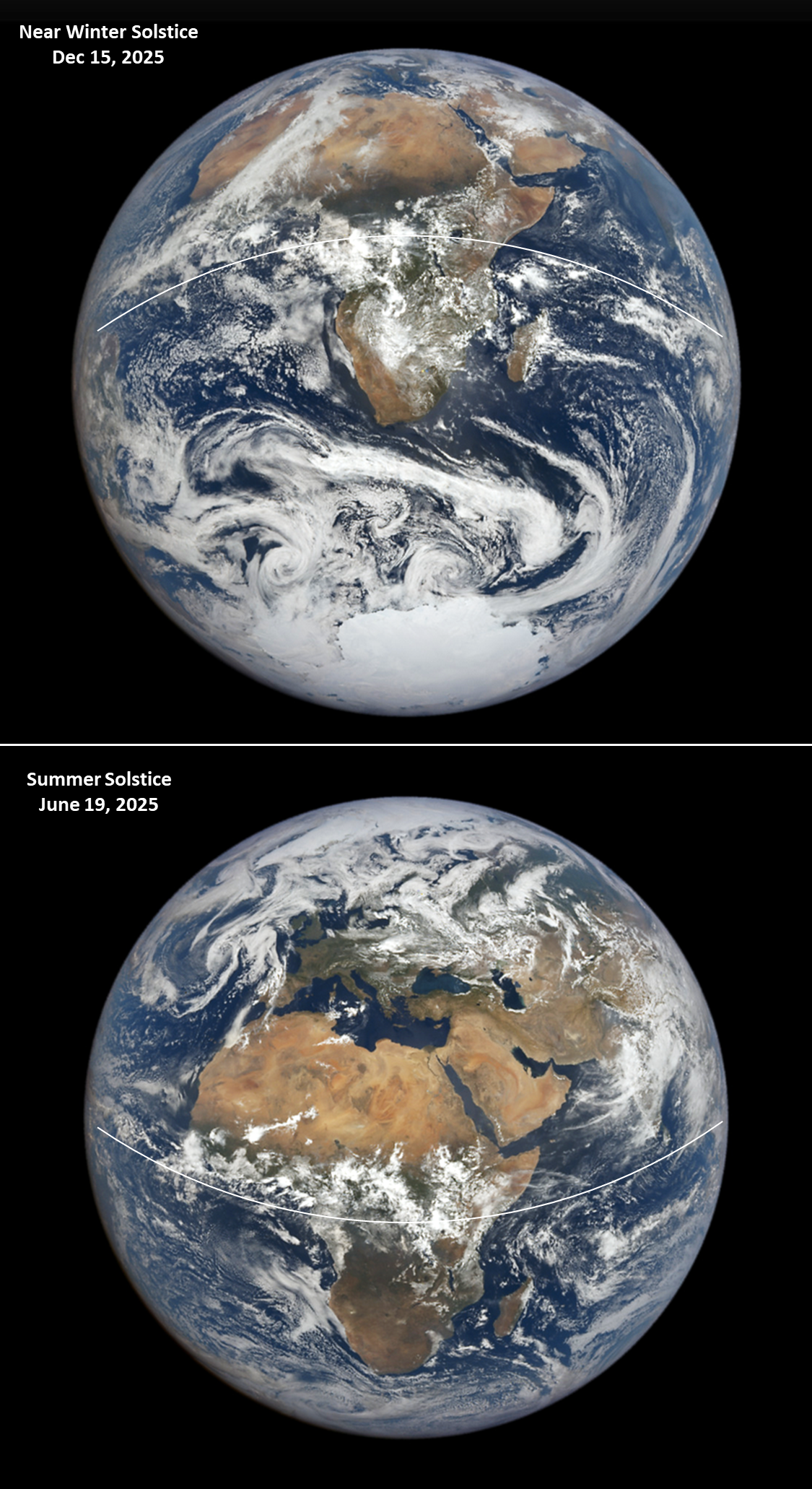
This image of Earth posted by ESA was taken by the Meteosat MTG‑I1 weather satellite 2 days ago on 19 December 2025 at 06:00 GMT. It vividly shows Earth’s day–night terminator line tilted near its annual maximum of about 23.5°.

MTG-I1 (Meteosat Third Generation Imager-1) is located in a geostationary orbit (35,786 kilometers) at 0 degrees longitude, directly above the Prime Meridian.

bsky.app/profile/esa.int/post/
3/n

Image of Earth posted by ESA, taken by the Meteosat MTG‑I1 weather satellite on 19 December 2025, at 06:00 GMT. It vividly shows Earth’s day–night terminator line tilted near its annual maximum of about 23.5°.
0

If you have a fediverse account, you can quote this note from your own instance. Search https://fosstodon.org/users/AkaSci/statuses/115757766686185932 on your instance and quote it. (Note that quoting is not supported in Mastodon.)