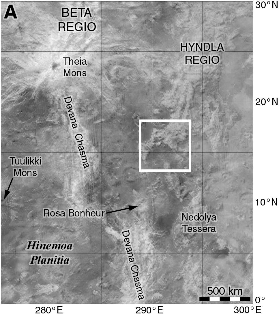
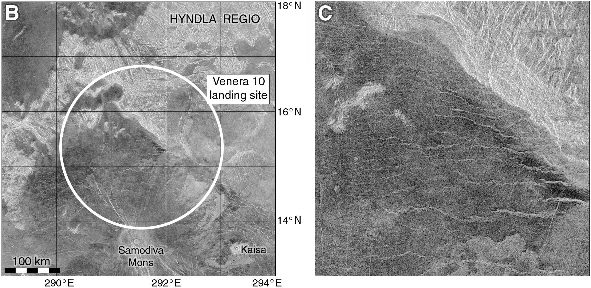
Venera 10 launched 6 days after V9 (14 June '75) and landed 3 days after its sibling (25 October). This map shows the area. Like Venera 9 it was east of Beta Regio, but 1500 km further south. As with all landers so far the target was essentially unknown, only seen in very low resolution radar reflectivity images from Earth. Here we see a landscape of bright (rough) and dark (smoother) features, which we will see closer tomorrow.

A map showing the landing area of Venera 10 in 1975. The site is southeast of Beta Regio in an area which was essentially unknown at the time but now seen (in Magellan data) to consist of mixed bright and dark - rough and smooth - patches. What kind of landscape did Venera 10 land in?

Venera 10 landed in the area shown here at two scales - at left a map spanning 500 km shows major landforms, at right, full Magellan resolution gives us details of part of the landing ellipse. We see mixed geology - the dark areas are smooth (ish) plains, probably sediments blown around by the wind. What makes sediment on Venus? Impacts, chemical weathering and maybe volcanic ash. A big bright area (Hyndla Regio) is an upland cut by many faults.

Two maps of the Venera 10 landing site. At left a context map shows bright and dark areas, the bright parts being a hilly area cut by many faults and the dark areas being smoother surfaces probably covered with sediments.  A mountain in the south part of the map is a volcano, and flows extend from it to the north and east. Venera 10 could have landed anywhere in a 300 km diameter circle filling much of the map. At right the central part of that landing region is shown in more detail revealing plains cut by ridges and fractures, and part of the hilly area.
0

If you have a fediverse account, you can quote this note from your own instance. Search https://mastodon.social/users/PhilStooke/statuses/115586488351424831 on your instance and quote it. (Note that quoting is not supported in Mastodon.)